🟢 Now protecting over 2,000 retail stores across Australia & NZ. Become a member
How It Works Membership
👤 For Individuals 🛒 For Retail 🏢 For Businesses 🏛️ For Government
About
🛡️ About Us 📋 Case Studies 🎙️ Media
FAQ Contact Become a Member Login

The Evidence Existed. Reaching It in Time Is the Problem.

In every one of these investigations, the footage, the camera, or the floor plan was already there. What cost investigators days, months, and sometimes the case itself was the slow, manual scramble to find it, locate the owner, and retrieve it before the trail went cold. That is the gap Safer Places Network is built to close.

Recommended by a Deputy State Coroner in 2022
Following the Théo Hayez inquest, the Coroner formally called for a mapped CCTV register: camera locations, owner contacts, retention periods, and download details, so police can identify relevant cameras and obtain footage quickly.
Deputy State Coroner Magistrate Erin Kennedy, Inquest into the disappearance of Théo Hayez, NSW. The exact infrastructure Safer Places Network provides.
Case 01 · Major Investigation

The Murder of Jill Meagher

Sydney Road, Brunswick, Victoria · September 2012
85 hrs
to get one shop's footage to police

In September 2012, the disappearance of Jill Meagher from Sydney Road in Brunswick gripped the nation. The breakthrough came down to a single camera at a local bridal shop, the Duchess Boutique, positioned inside the store, looking out through the front door past mannequins and stock. It captured Adrian Ernest Bailey speaking to Jill, setting off an investigative trail that was then corroborated by a toll-gantry camera tracking his vehicle.

Despite how decisive that footage proved to be, it took 85 hours to get it into the hands of Victoria Police. Discrete internal cameras are easily missed when investigators canvass a street for standard exterior CCTV, and an address can wrongly be written off as having no footage. Even once a camera is found, police spend hours tracking down the system's owner. The retrieval ultimately relied on a massive social media push. Because Jill was a journalist, a dedicated Facebook page gained 12,000 followers in 24 hours, and it was that exposure that finally prompted the owner to check the cameras. If this exact crime occurred today, the timeline would likely be very similar.

Critical evidenceInternal CCTV at the Duchess Boutique
CorroborationToll-gantry camera tracking the vehicle
Resource drain2-4 hrs per investigation just locating cameras
Time to retrieve85 hours
How it happened
0 hrs
Reported missing · 2:00 AM
Investigators begin canvassing Sydney Road on foot, looking for standard exterior CCTV.
Day 1
Hidden camera missed
The vital camera sits inside the boutique, facing out through the front door past mannequins and stock, and is easy to overlook. The address could easily have been written off as having no footage.
2-4 hrs each
Door-knocking for owners
Spotting a camera is only half the battle. Police then spend hours tracking down and contacting the person who actually owns the system to request access.
24 hrs
Reliance on luck and media
A dedicated Facebook page gains 12,000 followers in 24 hours. Only that intense exposure prompts the boutique owner to check their cameras and submit the footage.
85 hrs
Footage finally reaches police
Deep into the most critical window of a missing persons case. Tracking the offender's vehicle via the toll gantry then corroborates the trail.
With Safer Places Network
0 min
Reported missing · 2:00 AM
The watchhouse keeper opens the Safer Places digital map and instantly sees every registered camera on Sydney Road, including the boutique's internal one.
+2 min
No hunt for the owner
The hunt for the system owner is bypassed entirely: an automated SMS and email request goes directly to the registered owner.
+15 min
Remote upload
The boutique owner receives the notification and uploads the footage from anywhere in the world, without waiting for police to knock on the door.
Under 1 hr
Suspect still presented on the spot
Police print a CCTV still of the suspect and present it to her husband immediately, shifting the investigation into high gear almost at once.
Case 02 · Missing Persons

The Théo Hayez Disappearance

Byron Bay, New South Wales · May 2019
48 hrs
before footage starts overwriting on a loop

In May 2019, 18-year-old Belgian backpacker Théo Hayez vanished in Byron Bay after leaving a local bar. Despite extensive land searches, global media attention and a major investigation, his disappearance remains unresolved. In the frantic early days, investigators faced a critical hurdle: locating and securing private CCTV footage before systems automatically overwrote their data. Many residential and small-business systems run on a loop, overwriting old footage every 48 hours to 7 days.

Because police had no centralised way to know where cameras were, who owned them, or how long they stored footage, they were forced into a time-consuming manual canvas of Byron Bay's streets. By the time a camera was identified and its owner tracked down, vital clues had potentially already been erased. The 2022 Coronial Inquest, before Deputy State Coroner Magistrate Erin Kennedy, handed down a landmark recommendation directed at NSW Police: the urgent development of a mapped CCTV Register, precisely the infrastructure Safer Places Network provides.

The Coroner's registerMap locations of all known cameras
+ Owner detailsDirect contact for every camera owner
+ Retention loggedExactly when footage is overwritten
+ Download detailsSoftware specifics for rapid retrieval
How it happened
Hour 0
The overwrite clock starts
Residential and small-business CCTV systems begin looping over old footage within 48 hours to 7 days of the disappearance.
Days 1-3
Manual street canvas
With no centralised record of where cameras are, who owns them, or how long they store footage, police walk Byron Bay searching system by system.
Ongoing
The information void
Even when a camera is found, investigators struggle to determine the owner's contact details, the software specifics, and how to extract the files.
48 hrs+
Evidence lost to time
By the time cameras were manually identified, owners tracked down, and access requested, vital footage had potentially already been overwritten.
With Safer Places Network
Hour 0
The map already exists
Instead of walking the streets for hours, police open a digital map and instantly view every registered camera within the search radius of Théo's last known location.
+5 min
Beat the overwrite clock
Because the network logs how long each camera retains footage, police prioritise requests to the systems about to wipe their data first.
+10 min
Instant direct contact
Bypassing the need to physically track down owners, an SMS or email goes straight to the registered owner requesting the exact timeframe, to be uploaded remotely.
Same day
No evidence lost
Footage is secured before any loop can erase it, directly answering the Coroner's call for a digital CCTV register.
Case 03 · Counter-Terrorism

The Melbourne Synagogue Arson Attack

Adass Israel Synagogue, Melbourne · December 2024
1,400
locations canvassed over five months

In December 2024, a politically motivated arson attack at the Adass Israel Synagogue sparked a high-priority investigation by the Joint Counter Terrorism Team, made up of Victoria Police, the AFP and ASIO. To track the suspects' vehicle, a stolen blue VW Golf with cloned plates, investigators had to cast an enormous net: the car was also linked to an earlier arson at the Lux nightclub in South Yarra and a shooting in Bundoora, so its movements spanned vast sections of Melbourne's suburbs.

To piece the puzzle together, the JCTT manually sourced and reviewed footage from more than 1,400 locations, physically travelling to businesses and homes, locating owners, requesting files, waiting for downloads, and transporting the data back. Even once collected, raw footage from 1,400 proprietary systems and file formats is notoriously hard to process and synchronise. It took five months to confidently trace the vehicle and connect the crimes, with the CCTV compilation released to the public in May 2025.

Target vehicleStolen blue VW Golf, cloned plates
Linked crimesSouth Yarra arson · Bundoora shooting
Locations canvassed1,400+ camera sites
Time to traceFive months
How it happened
Week 1
A city-wide net
Because the same vehicle linked the synagogue arson, the South Yarra nightclub fire and the Bundoora shooting, investigators had to map movements across vast sections of Melbourne's suburbs.
Months 1-4
1,400 manual collections
Collecting footage from 1,400 locations means officers physically travel to each business and residence, locate the owner, request the files, wait for downloads, and securely transport the data to headquarters.
Ongoing
1,400 file formats
Raw footage from 1,400 different proprietary systems and file formats is notoriously difficult to process, synchronise and analyse.
5 months
Vehicle finally traced
Only in May 2025 were the vehicle's movements confidently traced, the crimes connected, and the CCTV compilation released to the public.
With Safer Places Network
Day 1
Instant digital dragnet
Investigators enter the make and model of the blue VW Golf; a targeted request instantly broadcasts to every registered business and homeowner along the arterial roads between South Yarra, Bundoora and the synagogue.
Hours
Cloud uploads roll in
Cooperating citizens across different suburbs upload clips immediately from the cloud, with no door-knocking of thousands of properties.
Days
Connect the dots
The link between the nightclub arson, the shooting and the terrorism incident emerges within days rather than months.
Week 1
Specialists stay on the case
Counter-terrorism detectives and the Arson Squad analyse intelligence and track suspects, instead of acting as IT support extracting files from 1,400 recorders.
Case 04 · Tactical Pre-Arrival Intelligence

The Dezi Freeman Manhunt

Victoria's High Country · August 2025 to March 2026
216 days
a heavily armed fugitive at large near communities

In August 2025, Dezi Freeman fatally shot two Victoria Police officers and triggered an unprecedented 216-day manhunt across Victoria's high country, ending in an armed standoff when he was located in March 2026. Throughout, local schools, hospitals and businesses sat at extreme risk. Had a fugitive like Freeman barricaded himself inside a nearby school, the situation would have instantly escalated into a worst-case active-shooter scenario.

This case points to a different capability, pre-arrival structural intelligence, but the same root problem: critical information exists, yet reaching it takes too long. If a shooter breaches a large facility today, it can take police hours to track down the right administrators, locate physical blueprints, and distribute accurate floor plans. Tactical officers are forced to clear unfamiliar, sprawling campuses blind, with no knowledge of secondary entries, blind corners, stairwells or designated lockdown rooms. Safer Places Network lets schools, hospitals and businesses securely upload their floor plans and schematics ahead of time.

IncidentTwo officers killed, fugitive armed
Manhunt length216 days across the high country
The blind spotNo instant structural intelligence
The fixPre-uploaded floor plans & schematics
Without pre-arrival intelligence
0 min
Threat breaches a facility
During the manhunt, an armed fugitive barricades inside a large, unfamiliar school or hospital campus. Instantly it becomes an active-shooter scenario.
Hours
The information gap
Police spend hours tracking down the correct administrators, locating physical blueprints, and distributing accurate floor plans to tactical teams on the ground.
Ongoing
Clearing blind
Tactical officers clear sprawling, unfamiliar corridors with no knowledge of secondary entry points, blind corners, stairwells or designated lockdown rooms.
Every minute
Delay costs lives
Each minute without structural knowledge endangers both the civilians sheltering inside and the officers entering.
With Safer Places Network
In advance
Plans uploaded ahead of time
Schools, hospitals and commercial businesses securely upload their floor plans and site schematics to the network in advance.
0 min
Instant secure access
In a crisis, emergency responders and command centres are granted immediate, secure access to the building's uploaded blueprints.
En route
Plan while approaching
Tactical teams map entry and exit points, locate secure lockdown zones, identify chokepoints and plan evacuation routes while still on their way to the scene.
On arrival
Precision response
Command directs officers with absolute precision, eliminating the deadly delay of navigating an unfamiliar environment.
The investigations referenced above are public cases included to illustrate a systemic gap in evidence retrieval, and are presented factually and respectfully. They do not imply that Safer Places Network was involved in those specific investigations.
Get The App

Take Safer Places With You

Add your contact details, register your cameras and dashcams, and get real-time local alerts, wherever you are. Available now on iOS and Android.
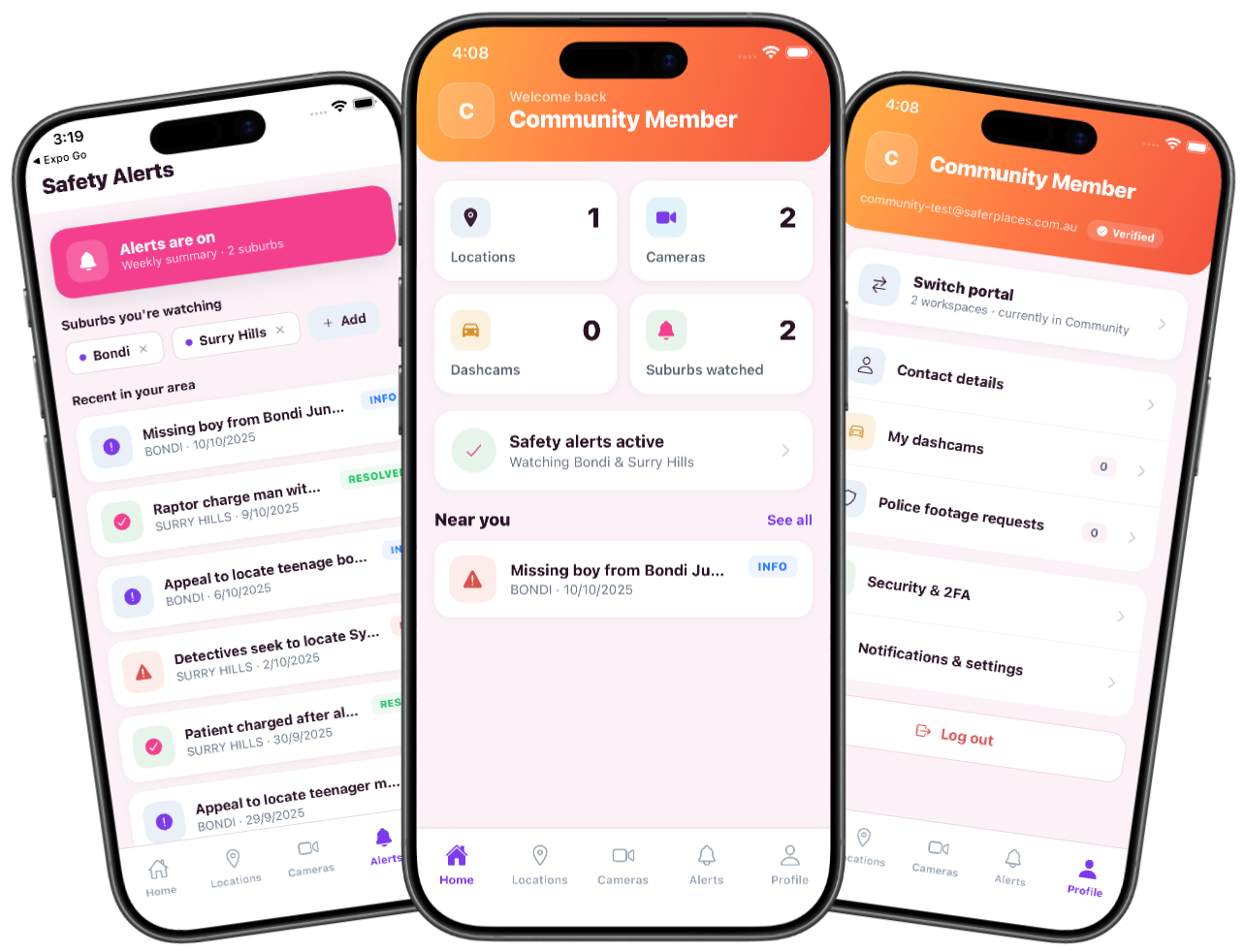
Safer Places Network Mobile App

Help Close the Gap

Register your cameras and be part of the network that gets evidence to police in minutes, not months.

Become a Member Now